Mon - Fri: 8 am - 4 pm MT

About Backcountry Journeys
Why Choose Backcountry Journeys
If you're considering a photography trip, hear why Backcountry Journeys delivers the best experience in the industry.Frequently Asked Questions
If you're new to photography trips, or new to BCJ, you can find our common travel questions here.Fitness Levels
Our trips vary on physical intensity, and by reviewing our fitness levels, you can find out which trips may be more challenging, or aligned more closely with your comfort level.Meet The Crew
We've built an amazing team of experienced guides, and dedicated office staff that elevate your travel experience. Get to know their backgrounds, and hear their stories.Loyalty Program
We reward our frequent photo adventurers with exclusive discounts on amazing photography trips.Contact Us
If you need to get in touch with our office staff, or have additional business inquiries, you can find our information here.Refer a Friend
Know someone perfect for one of our tours? Recommend them through this quick form.Stay Up To Date On All Things
Backcountry Journeys
Backcountry Journeys
Our Photography Community
Our Webinars
Our regularly hosted webinars provide photography instruction from our own guides on a wide range of topics.Our Education Portal
Explore our library of articles that cover everything from common questions, to in-depth guides on how to achieve that perfect shot.Community Testimonials
We're proud to foster an amazing group of photo travelers, and here you can find their stories from their past adventures.Resources For Photographers
About Our Company
Resources For Photographers
About Our Company
Trip Report: Southwest Monsoon - July 2022
Published October 3, 2022
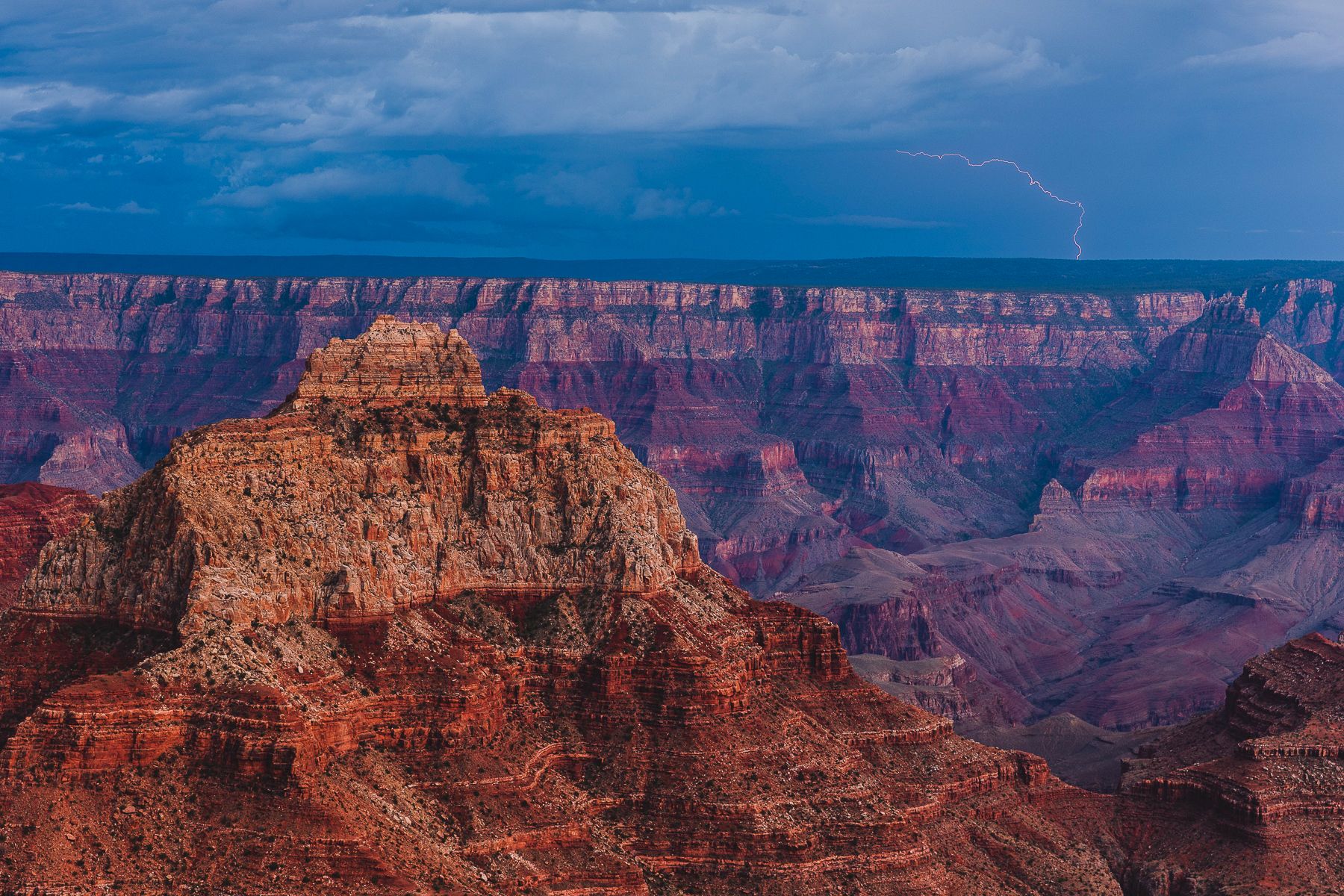
Lede: I mean, you could not have drawn things up any better. Lightning bolts were popping off in nearly every direction. And at a perfect distance for safety. Storms were off to the east, to the northeast, and across the South Rim of the Grand Canyon as far as the eye could see. Sheets of dark rain and dust like curtains projecting from low-hanging royal blue clouds. A show that would make even the most ardent pyromaniac proud of. The natural world putting on a show and providin, in real time, proof that Monsoon is a thing in Arizona.
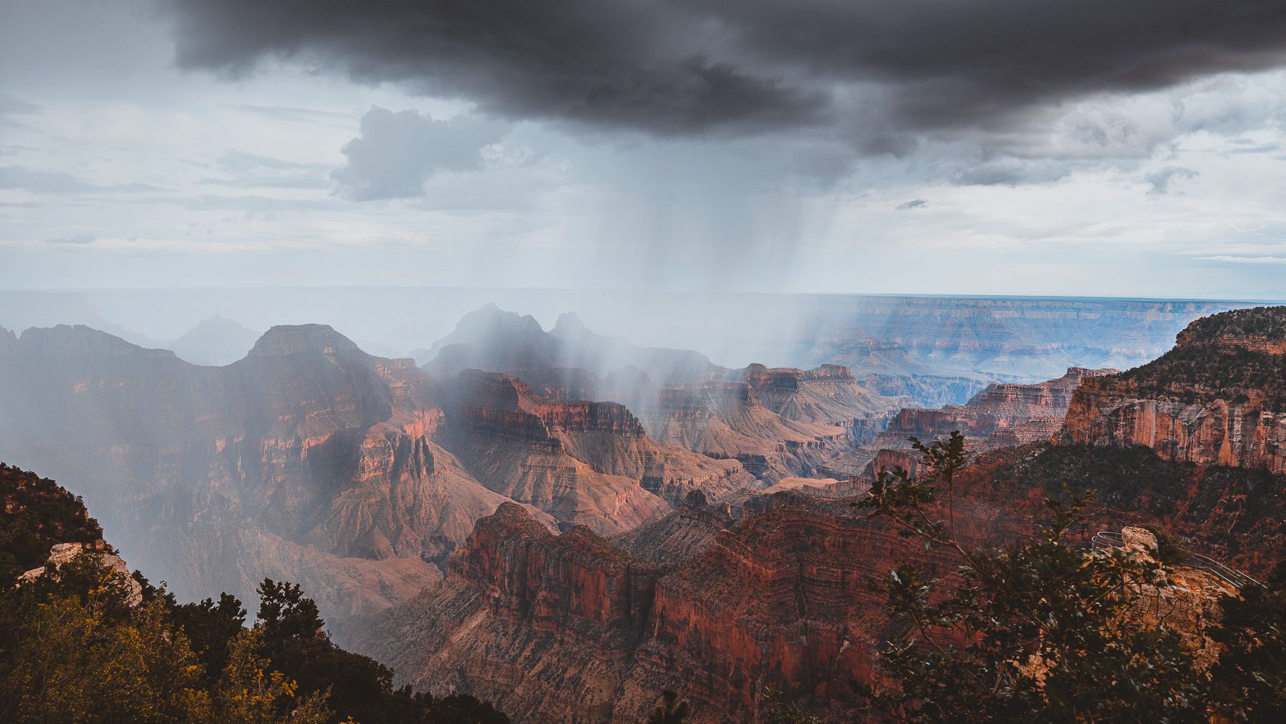
Perched on a rocky outcropping on the rim of the north east side of the Grand Canyon, at a place called Cape Royal, our little group of Backcountry Journeys photographers were firing on all cylinders as we burned through batteries and memory trying to capture the events in a photographic story that could live for years! There were certainly images out there worthy of printing and hanging, and the thrill of the moment remains difficult to properly describe.
Far below us the muddy Colorado River, near a historically significant Unkar Delta, a location rich with the remnants of dwellings used by ancestral Puebloans. They lived and farmed in the area from about A.D. 850 to 1200, planting corn, squash and beans on irrigated fields and terraces near the river and creek.
Inner Canyon rock features, Vishnu Temple and Woton’s Throne are both prominent here.
Nights like these make the hairs on your arms and neck stand at attention, so much electricity in the air both figuratively and literally.
“Oooh!!! NAILED IT!” exclaims Craig, one of our group members with his heart and lens set on getting a lighting shot. His Lightning Trigger was firing off left and right.
“Boo-Yeah!!! DID YOU SEE THAT ONE!?!?!?” yells another onlooker.
“Oh, we got it,” says Craig, confident his camera is getting the shots. It went on like this for hours. We arrived at our sunset shot location well prior to sunset, not only to stake a claim on the spots we wanted, but also to take advantages of excellent late-afternoon light that comes with the big clouds and ranging storms of the Arizona monsoon. We could shoot nearly all day, and we did.
I digress back a few days, though, as this fantastic night was our final night together following a nearly a week of travels, exploration, and amazing photography at truely iconic locations across Northern Arizona and extreme southern Utah.
The trip met several days prior in Flagstaff, Arizona. As with all BCJ trips, we begin with an orientation meeting and dinner as a way to get to know each other, get questions and concerns answered, and to generally get things kick-started right!
The morning following our orientation, we set off on Highway 89 north out of town pointing our compasses towards Navajo Nation and its prized Monument Valley. Being allowed back at Monument Valley was certainly a treat as the past two years the park, run by the Navajo Tribe, had remained closed due to COVID. This group would be the first BCJ group back at Monument Valley since the 2019 trip!
This year we’d be staying at nearby historic Goulding’s Lodge. What is now Goulding’s Lodge was opened as a trading post by Harry Goulding and his wife, Mike, in the early 1920’s, long before anyone knew about the now treasured rock “monuments” across the way. It was Goulding, in fact, who is responsible for the popularity of Monument Valley. During the Great Depression of the 1930’s, the Navajo reservation was suffering greatly. Harry had an idea. He and Mike set out for Hollywood, California and was able to score a meeting with director John Ford, who was scouting locations for an upcoming film. By showing Ford a plethora of photographs of the region, Goulding convinced Ford to bring that film to Monument Valley and with the release of Stagecoach, Monument Valley, and John Wayne, became famous. The rest is history, as they say.
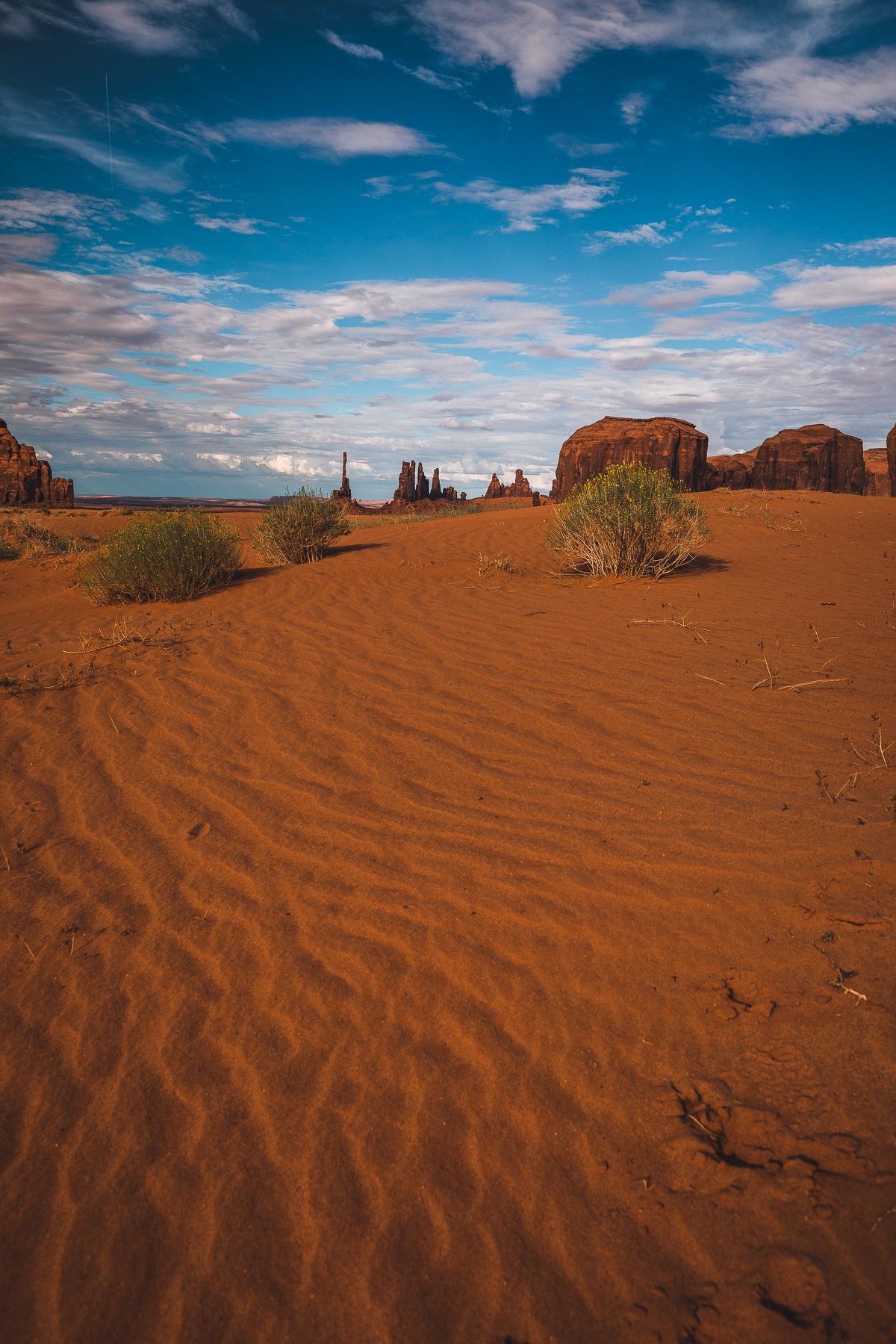
Geoloically, Monument Valley is a region of the Colorado Plateau characterized by a cluster of sandstone buttes, the largest reaching 1,000 feet above the valley floor. It is located on the Utah-Arizona state line, near the Four Corners area. The valley is a sacred area that lies within the territory of the Navajo Nation Reservation.
Our group was treated to two separate driving tours led by Jonathan Cly, who’s family has lived in and around Monument Valley for generations. Jonathan was able to expertly take us from outstanding location to outstanding location providing stories about the significance of each spot, and rock, along the way. We were able to get into locations off-limits to the average tourist. We stayed through sunset.
Our group was treated to two separate driving tours led by Jonathan Cly, who’s family has lived in and around Monument Valley for generations. Jonathan was able to expertly take us from outstanding location to outstanding location providing stories about the significance of each spot, and rock, along the way. We were able to get into locations off-limits to the average tourist. We stayed through sunset.
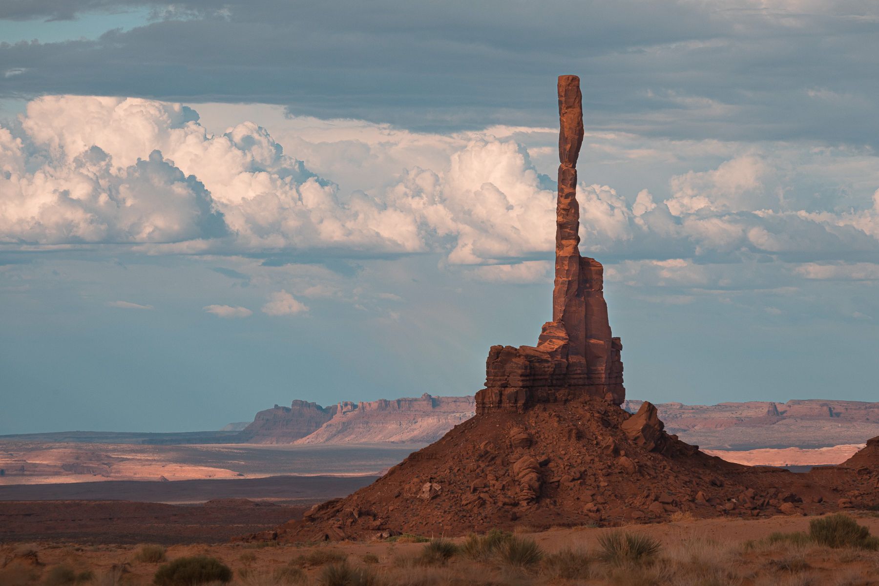
A morning session at Gump Point (the spot where Forrest Gump got tired of running) provided nice light on a sprawling look at the landscape complete with the classic stretch of highway leading up to it.
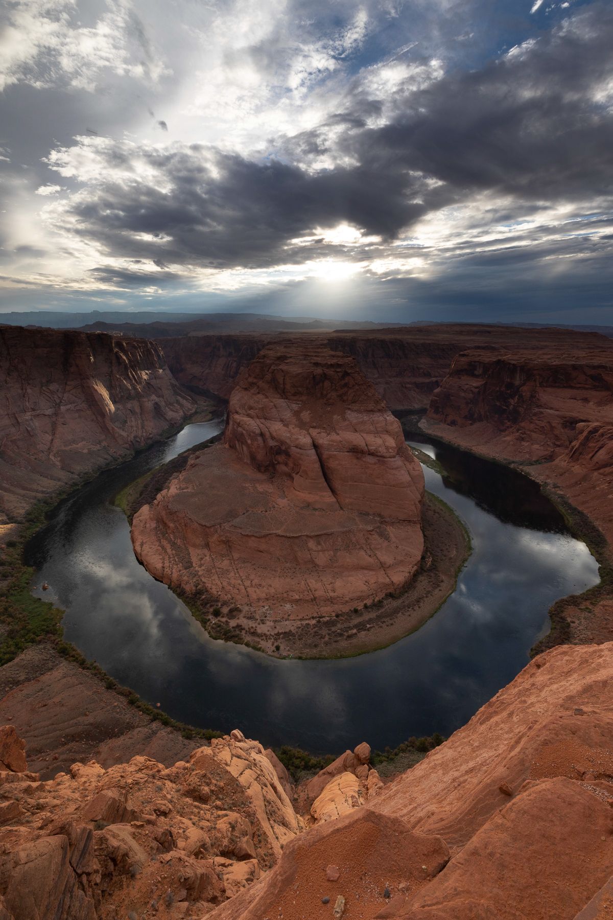
Following brunch, we moved on towards Page, Arizona, which placed us in perfect location for our next two locations: Horseshoe Bend and Antelope Canyon X.
Following brunch, we moved on towards Page, Arizona, which placed us in perfect location for our next two locations: Horseshoe Bend and Antelope Canyon X.
Over the past several years, Horseshoe Bend has become one of the more famous locations for social media enthusiasts, which has contributed to a great deal of development, and crowds, at the site. What not all that long ago was an easily missed dirt patch (parking) and small foot trail up and over a hill, has become a massive and sprawling paved and paid for parking lot, a redirected and well-built trail that takes a more meandering approach so as to be more friendly, as well as shade structures and mostly ignored safety railings. But, none of this takes away an ounce of the amazingness of this spot. Below the rim, the Colorado River makes a wide sweep around a sandstone escarpment. On its long downward journey to the sea, the river meandered, sometimes making wide bends, but always seeking the path of least resistance. Around 5 million years ago, the Colorado Plateau uplifted and the meandering rivers that crossed the ancient landscape were trapped in their beds. Over time, the rivers cut through the uplifted layers of sandstone. Here at Horseshoe Bend, the Colorado River created a roughly 1,000 ft deep, 270º horseshoe-shaped bend in Glen Canyon. And its breathtaking to photograph, even if there are very few ways to make a truly unique composition here. Our group enjoyed the scene, complete with clouds and corpuscular rays (God beams). No lightning or sheets of rain as a backdrop on our night here, but nonetheless Horseshoe Bend provided a beautiful evening and beautiful shots. We were able to practice bracketing and exposure blends with these images, a very useful tool for landscape photographers, especially those landscapers who enjoy photographing canyons at sunrise and sunset. Times when dynamic range can create challenges.
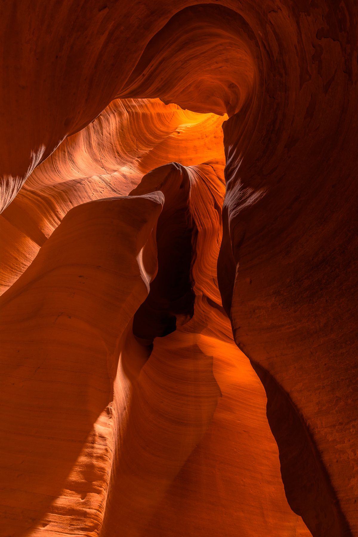
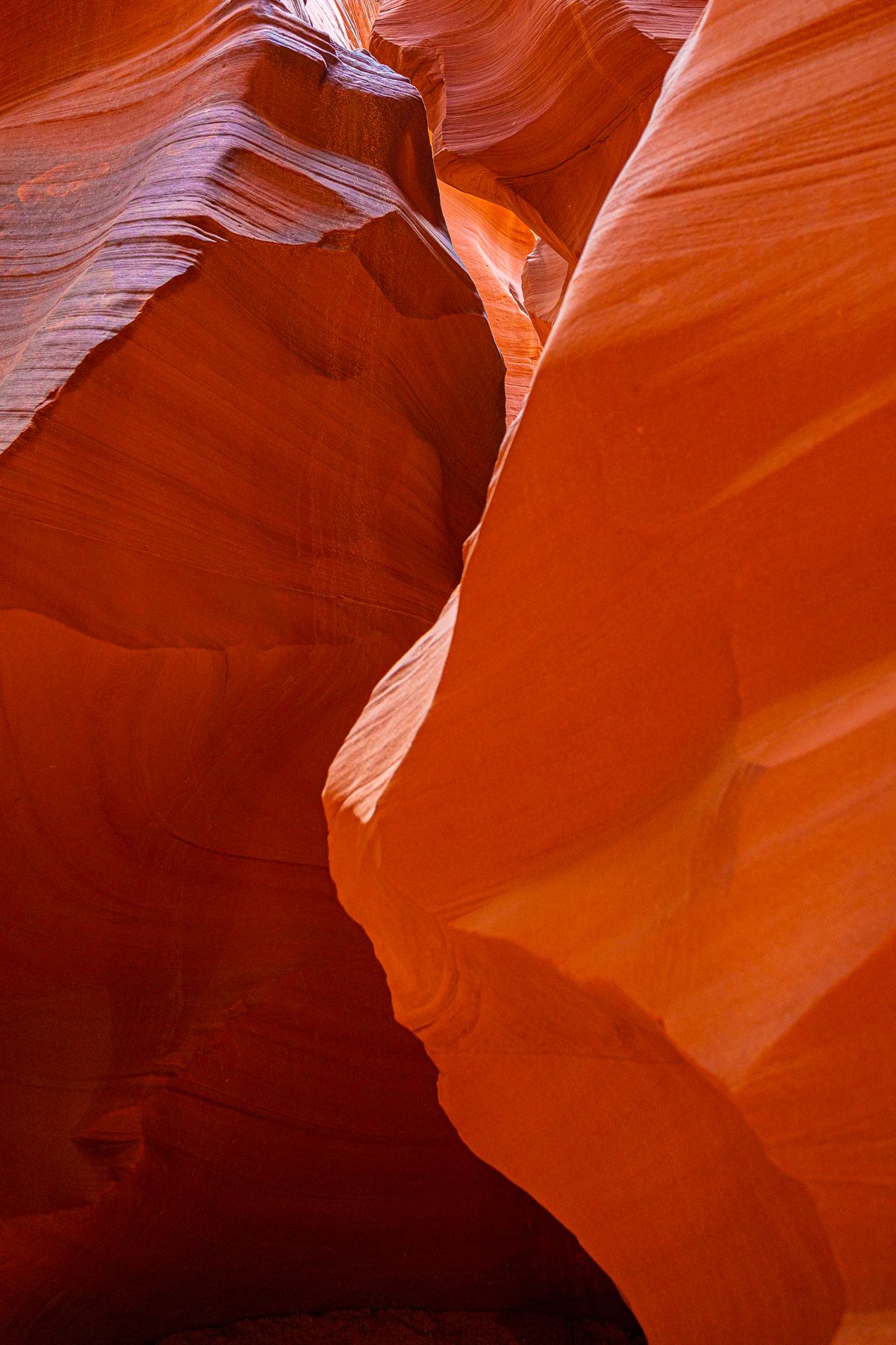
Antelope Canyon has formed it signature look through long-term erosion of the 200 million year old Navajo sandstone. Antelope Canyon was formed by the erosion of Navajo Sandstone due to flash flooding and other sub-aerial processes. Rainwater, especially during monsoon season, runs into the extensive basin above the slot canyon sections, picking up speed and sand as it rushes into the narrow passageways.] Over time the passageways eroded away, deepening the corridors and smoothing hard edges to form characteristic "flowing" shapes
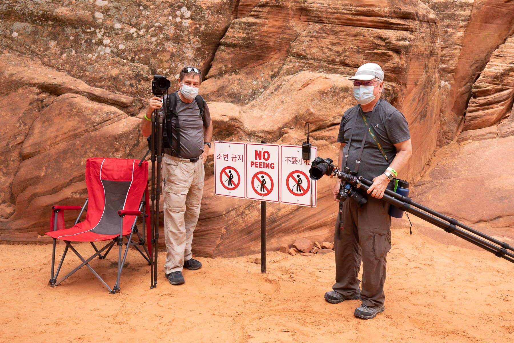
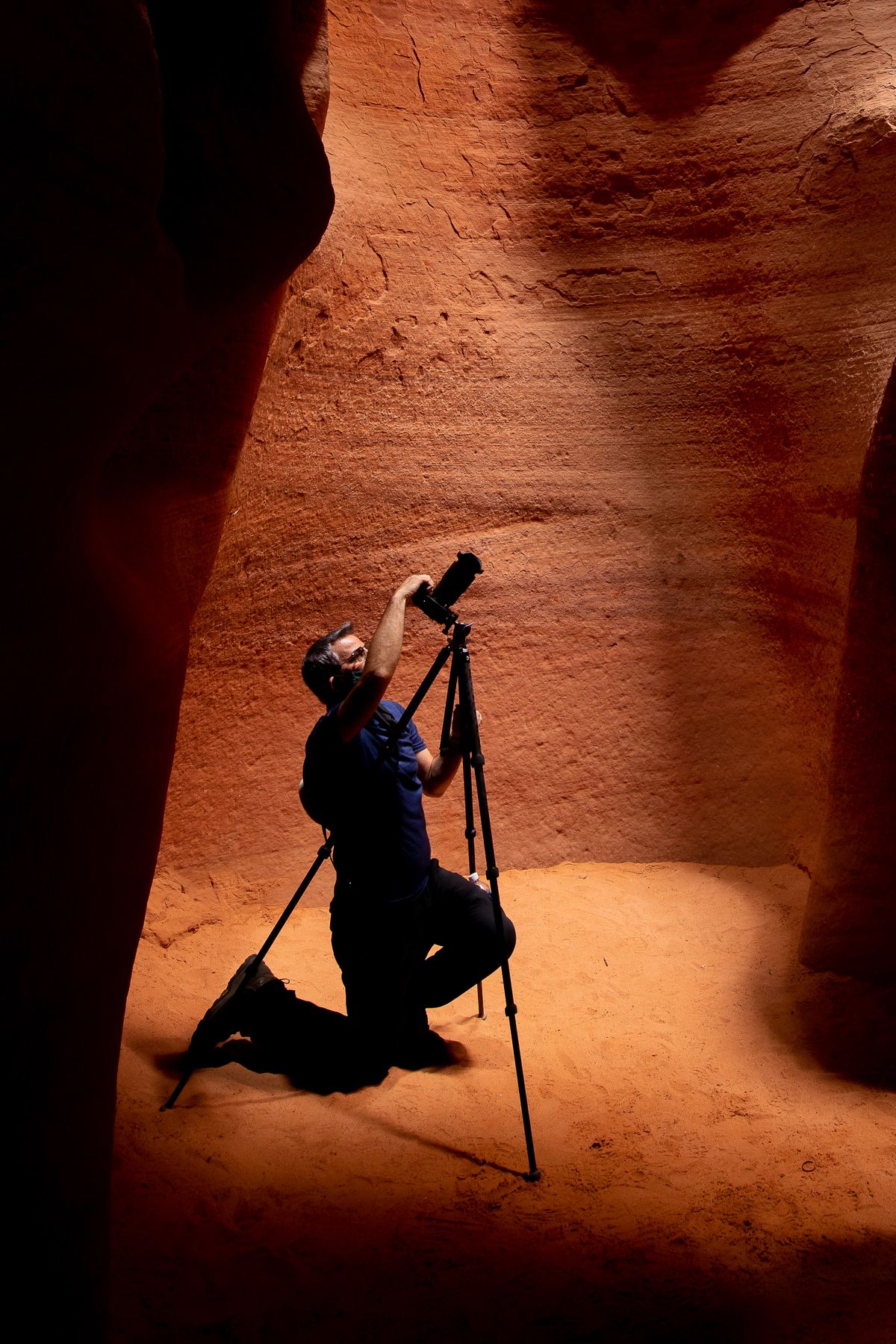
Antelope Canyon X is a slot canyon located in the same canyon as the famed Upper and Lower Antelope Canyons. At Antelope Canyon X, a sole tour operator, Taadidiin Tours, limits the number of guests in the Canyon at a particular time, and, more importantly for BCJ tours, they still offer Photography Tours allowing for tripods, DSLR and Mirrorless cameras and provide Canyon scenes without tourists.
Antelope Canyon has formed it signature look through long-term erosion of the 200 million year old Navajo sandstone. Antelope Canyon was formed by the erosion of Navajo Sandstone due to flash flooding and other sub-aerial processes. Rainwater, especially during monsoon season, runs into the extensive basin above the slot canyon sections, picking up speed and sand as it rushes into the narrow passageways.] Over time the passageways eroded away, deepening the corridors and smoothing hard edges to form characteristic "flowing" shapes
Antelope Canyon X is a slot canyon located in the same canyon as the famed Upper and Lower Antelope Canyons. At Antelope Canyon X, a sole tour operator, Taadidiin Tours, limits the number of guests in the Canyon at a particular time, and, more importantly for BCJ tours, they still offer Photography Tours allowing for tripods, DSLR and Mirrorless cameras and provide Canyon scenes without tourists.
There are two stretches of canyon here, one is an “A” shaped canyon, the other is “V” shaped. “A” shape means the canyon is wider at the bottom, narrower at the top. “V” shape means the opposite, narrower at the bottom, wider at the top. During this year’s tour there were more tourists than normal due to closures at Lower Antelope due to flooding issues. While the additional lookie loos did provide more challenge than we typically have in getting clean scenes without people, it did still work out and we were grateful to Taadidiin for ensuring we had an opportunity first by remaining open after the flooding, and then by helping to keep canyons free of tourists for quick captures by our group.
The drive from Page to the N. Rim is a fantastic one. There are few drives more quintessential American Southwest than the one that makes its way across the Navajo Sandstone at Page, down the slopes to the Marble Platform, at 3,000ft elevation, across the Colorado River (as such across the Grand Canyon at one of its narrowest portions), through the Vermillion Cliffs before gaining 6,000+ feet ascending the Kaibab Plateau and the N. Rim of the Grandest Canyon of them all.
3-5 grafs about the N. Rim. The Lodge. The viewpoints. Be descriptive with what its like to be there, surrounded by towering and fragrant ponderosa pines with a sprinkling of white-bark aspen trees that grow well here at 8,000 ft. The busier South Rim sits visible, only 14 miles across the canyon, yet 5+ hours drive and a world away. There are no crowds here. Time slows. An afternoon spent watching the clouds cast shadows across the features of the Canyon is one not of waste, or of leisure but more of necessity of the soul. Its fuel for the gas tank. And, during Monsoon, it is also strategic if you have your heart set on photographing lightning, which most of our group certainly was!
3-5 grafs about the N. Rim. The Lodge. The viewpoints. Be descriptive with what its like to be there, surrounded by towering and fragrant ponderosa pines with a sprinkling of white-bark aspen trees that grow well here at 8,000 ft. The busier South Rim sits visible, only 14 miles across the canyon, yet 5+ hours drive and a world away. There are no crowds here. Time slows. An afternoon spent watching the clouds cast shadows across the features of the Canyon is one not of waste, or of leisure but more of necessity of the soul. Its fuel for the gas tank. And, during Monsoon, it is also strategic if you have your heart set on photographing lightning, which most of our group certainly was!
Time slows down at the North Rim. Its difficult to explain why, but it is something anyone who has been there will confirm. Things just move slower. There are far less visitors here than at the South Rim. Grand Canyon averages about 6 million visitors annually, and 95% of those folks visit the south side. The north side is far from large cities with airports, and there are fewer lodging and dining options. Perfect for our group! We had lodging at the beautiful and rustic rim-side Western Cabins, by far the nicest lodging options anywhere at Grand Canyon, complete with front porch, rocking chairs, and fireplaces (usable even in summer, believe it or not!).
Each day for our group while at the North Rim involved a very early wakeup call for sunrise shot, each of our three mornings at a different vantage point. We’d break after breakfast allowing folks to spend time with the Canyon in a manner they’d like. Whether that is sitting in the adirondack chairs on the back patio, painting in the famed lodge Sun Room, or taking a walk through the woods along the rim, time was spent well during the morning. This allowed for afternoon sessions on the Lodge patio with cameras photographing storms. Storms populated each afternoon and provided opportunities for great images, even some lighting. Evenings we’d head out to a location for late afternoon light and storms.
The final evening was a treat. One of those shoots that does a good job defining the entire trip. Everything we had been in search of throughout the week was on display to a point where at times it was difficult to decide where to point. Even in the midst of all that action, though, there was time to stop, if only for a few moments, to look around. To pinch yourself and take a deep breathe.
“Is this even really happening?”
Few locations exist in the world that offer so many iconic natural locations than in northern Arizona. In just 6 + days our group of 7 photographers and two guides were able to see a handful of spots that people from around the world travel to see to complete life lists. We did it all. We photographed it all. We caught some lightning bolts, and saw the monsoon in all of its glory, as a well-placed backdrop to these iconic spots, just as we had planned.
What success! A big thank-you to our group for being up for anything, and flexible to pivot on a dime, as a photography trip looking for storms, lightning and light needs to be! Thanks also to my co-guide, Jose Martinez, who was shadowing this as his very first Backcountry Journeys trip.
What success! A big thank-you to our group for being up for anything, and flexible to pivot on a dime, as a photography trip looking for storms, lightning and light needs to be! Thanks also to my co-guide, Jose Martinez, who was shadowing this as his very first Backcountry Journeys trip.

We offer world-class travel photography
experiences around the world.
Each tour is bundled with lodging, meals, and transportation between workshops included, allowing you to focus on photography instead of the stress of traveling.
experiences around the world.
Each tour is bundled with lodging, meals, and transportation between workshops included, allowing you to focus on photography instead of the stress of traveling.
Get Our Trip Catalog
Receive a trip catalog that highlights all of our upcoming photo tours and workshops.Schedule a Trip Consultation
Meet with a photo experience coordinator, and experience a personal touch to your booking experience.Landscape Guide
Receive a FREE Landscape Cheat Sheet Written By a Pro Photographer.Webinars
Our regularly hosted webinars provide photography instruction from our own guides on a wide range of topics.Education Portal
Explore our library of articles that cover everything from common questions, to in-depth guides on how to achieve that perfect shot.
Backcountry Journeys
Connecting Passionate People To
Exceptional Experiences.
Exceptional Experiences.
Business Hours:
Mon-Fri, 8AM-4PM MT
928-478-1521
adventure@backcountryjourneys.com
Mon-Fri, 8AM-4PM MT
928-478-1521
adventure@backcountryjourneys.com
arrow_drop_down_circle
Divider Text
All Images & Content Are Property Of Backcountry Journeys Photography Tours, Workshops & Safaris LLC - Copyright 2026
About Us
Receive a Digital Trip Catalog
Find an upcoming photography tour with our interactive catalog.