2024 Travelers' Choice

About Backcountry Journeys
Why Choose Backcountry Journeys
If you're considering a photography tour, hear why Backcountry Journeys delivers the best experience in the industry.Frequently Asked Questions
If you're new to photography tours, or new to BCJ, you can find our common travel questions here.Fitness Levels
Our trips vary on physical intensity, and by reviewing our fitness levels, you can find out which trips may be more challenging, or aligned more closely with your comfort level.Meet The Crew
We've built an amazing team of experienced guides, and dedicated office staff that elevate your travel experience. Get to know their backgrounds, and hear their stories.Gift Certificates
Give the gift of photo adventure! We offer gift certificates that can be applied to any of our upcoming tours.Loyalty Program
We reward our frequent photo adventurers with exclusive discounts on amazing photography tours.Contact Us
If you need to get in touch with our office staff, or have additional business inquiries, you can find our information here.Stay Up To Date On All Things
Backcountry Journeys
Backcountry Journeys
Our Photography Community
Our Webinars
Our regularly hosted webinars provide photography instruction from our own guides on a wide range of topics.Our Education Portal
Explore our library of articles that cover everything from common questions, to in-depth guides on how to achieve that perfect shot.Community Testimonials
We're proud to foster an amazing group of photo travelers, and here you can find their stories from their past adventures.Resources For Photographers
About Our Company
Resources For Photographers
About Our Company
A Personal Trip Report: Trekking and Photographing Around the Everest Region
Published December 29, 2019
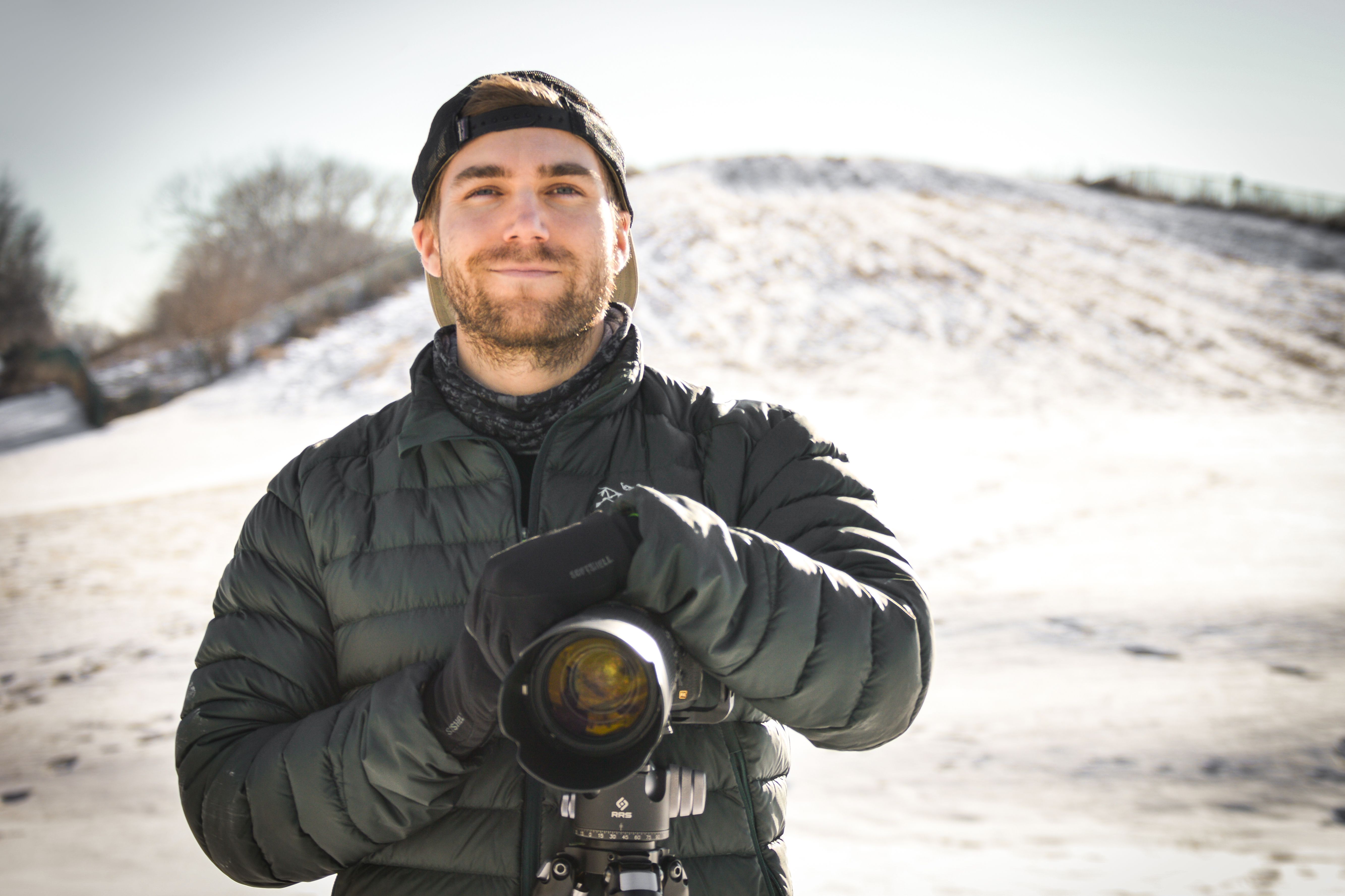
Nepal, and the Everest Base Camp Trek, in particular, has always been one of the trips at the top of my bucket list. The allure of seeing the tallest mountain on the planet and plenty of other 8000-meter peaks attracts everyone who loves the outdoors, and I was no different.
About eight years ago I first started researching the logistics of the trip and what it would take to complete the trek. At the time, photography wasn’t really a priority, I was working at Denali National Park and I just purchased my first camera. Fast forward to 2018 and my life is completely focused on photography – don’t get me wrong, I love the outdoors and backpacking, hiking, kayaking, I love it all, BUT most of my personal trips are focused on photography. I always have goals of the types of shots I want to come back with from a trip.
In 2018, I was finally in the right situation to fulfill my dreams of hiking in the Himalaya so of course, I went for it. I did a lot of research, even more planning, and learned a lot after I actually completed the trek. I wanted to share some insight into my trip and some information for others who might be interested in doing it themselves. I saw such a large demographic on the trail, from kids not even 20 years old to people in their 60’s (one who had summited Everest multiple times!). The fact is, I think most people in decent shape can do this trek. Below, I’ll share my thoughts on the logistics and photography prospects for a trek around the Everest Region.
Map

When to Go
Nepal experiences a seasonal monsoon and the best time of year to trek in the Himalayas of Nepal is April – May or September – November. The monsoon season runs June – August and although conditions can be great for photography, the mountains are often hidden in the clouds.
The Route
The majority of people start their trek from Lukla, there are other options, but Lukla is the easiest. You begin by flying into the world’s ‘most dangerous’ airport, Tenzing-Hillary Airport. There are other options, but they involve more hiking and more days. Once you get to Lukla, it takes 12-20 days depending on your route to reach Everest Base Camp.
The quickest route covers about 80 miles roundtrip, the long duration of time is due to the extreme elevation of the hike. The trek starts at 9,000 feet and eventually maxes out at 17,000 feet at Everest Base Camp (or 18,500 feet if you hike to Kala Patthar). Proper acclimatization is essential for the hike.
Itinerary
Day 1: Arrive in Kathmandu (1350m).
Arrive in Kathmandu and get some rest. Stay in the Thamel area, it is lined with gear shops and is where everyone spends their nights before/after trekking.
Day 2: Kathmandu – Lukla (2840m) – Phakding (2610m)
Fly to Lukla and immediately begin your hike. The trek to Phakding is relatively easy. Ups and downs, but plenty of places to rest and eat along the way. You will have to buy a park permit, but there is a station right on the trail and you will be stopped to apply and pay during the trek.
Day 3: Phakding – Namche Bazaar (3440m)
This is a tough day, with a climb up to Namche Bazaar. Namche is a bustling village, with much to see and do. A tough day, but you get a full day to acclimatize tomorrow and rest.
Day 4: Acclimatization day in Namche Bazaar
I recommend hiking to the Everest View Hotel for great views of Ama Dablam and Mount Everest in the distance. A great spot for sunset.
Day 5: Namche Bazaar – Tengboche (3860m)
The hike to Tengboche is relatively easy. Tengboche offers great views of Ama Dablam, one of my favorite mountains along the way.
Day 6: Tengboche – Dingboche (4410m)
Another fairly flat trek. Dingboche is one of my favorite places along the trek. It has great photography options. Spend extra days here if you can.
Day 7: Acclimatization day in Dingboche
The Pheriche Valley is beautiful and offers great shots of Cholatse. The hike up the hill next to Dingboche offers one of the best views of Ama Dablam. And, the hike to Chukkung is a good side hike and again offers great views of Ama Dablam.
Day 8: Dingboche – Lobuche (4910m)
The hike to Lobuche covers the Pheriche Valley, one of the most epic of the entire trek. The views are massive with 20,000-foot peaks everywhere you look.
Day 9: Lobuche – Gorak Shep (5140m) – Everest Base Camp (5364m)
A final push will get you to Gorak Shep. Gorak Shep was the least nice place I stayed during my trek, due to the high elevation and influx of climbers (=lots of garbage). Continue on to Everest Base Camp!
Day 10: Gorak Shep – Kala Patthar (5550m) – Pheriche (4240m, 6-7 hours walking)
The best view of the entire trek can be had from Kala Patthar. It is a climb and the highest point of the trek, but the views of Everest and Lhotse are incredible. One of the best views I have ever experienced. After, continue back and spend the night in Pheriche.
Day 11: Pheriche – Namche Bazaar (3440m)
Pheriche to Namche is mainly downhill, but some ups and downs. Namche is a great place to shower or splurge on gifts when returning.
Day 12: Namche Bazaar – Lukla (2840m)
Finally, return to Lukla and spend the night in one of the teahouses right next to the airport.
Day 13: Lukla – Kathmandu
Fly back to Kathmandu and prepare for your flight home. I recommend returning to Lukla 1-2 days I advance, as flights are often canceled and rescheduled due to poor weather. Always book the first flight in the morning, as that’s when flying conditions are best.
Notes:

Above is a general itinerary for the route to Everest Base Camp. Personally, I took 20 days and spent extra days in Namche Bazaar, Dingboche, and Gorak Shep for photography. Conditions in the mountains are constantly changing, so I stayed in a few areas longer to increase my chance of getting good light in spots where I wanted shots.
Doing the route too fast is dangerous because of altitude sickness as well. I recommend taking as many days as you can. There are other great additions to the Everest Base Camp trek too. I recommend looking into adding the Goyko Region. Because of snow and inclement weather, I was unable to reach Gokyo, but it is one of the most scenic and photogenic areas in the Everest Region.
There is wireless access along much of the route at various teahouses, but you do have to pay. Same with power, you can always charge things at teahouses, but be prepared to pay per charge. Travel insurance is a great idea for this trip. Flights get canceled, you could get sick and have to take a helicopter evac flight to lower elevations, and many other things could happen. Protect your trip!
Packing List
Backpack
- Osprey Aether 70 Backpack
Sleeping Bag
- Marmot Helium 15 Down Sleeping Bag
Footwear
- Brooks Cascadia 12 Trail Running Shoes
Shell/Rain Jacket
- Arcteryx Beta AR Shell Jacket
Down Jacket
- Rab Neutrino Endurance Down Jacket
Apparel
- 2 x Wool Long-sleeve Shirts
- 1 x Patagonia Capilene 4 Baselayer
- 1 x Marmot Scree Softshell Pants
- 2 x Wool Socks
- 2 x Wool Long Underwear
- 1 x ExOfficio Underwear
- Wool Hat
- Buff
- Gloves
- Quick-drying Camp Towel
Electronics
- Anker Astro E1 Power Bank
- Black Diamond ReVolt Headlamp
- Phone Charger
- 2 x Nepal Power Plug Converters – Type D
- 4x AAA Batteries
- Garmin inReach GPS
Water
- 1 Liter Nalgene
- LifeStraw Go
- SteriPen Adventurer
- Iodine Purification Tablets
- 12 x Electrolyte Packets
Health
- First Aid Kit
- Z-Pak Antibiotic
- Diamox
- SPF 50 Sunscreen
- Toiletries
- Toilet Paper (not available on the trail unless you pay)
Photo Gear
- Nikon D810
- Nikon 14-24mm f/2.8
- Nikon 70-300 AF-P FX
- Fotodiox WonderPana 145mm CPL
- 6 x batteries
- Zeiss Lens Cleaning Wipes
- 10 x lens clothes
Photography
I had extremely high hopes for my own photography, but I found the area extremely hard to photograph. The peaks are absolutely incredible. They are towering and majestic, but a lot of the landscape is barren, lots of rock deposited by glaciers and bare ground. I found foregrounds very challenging without snow. With that being said, I created a quick list of my favorite photography spots along the trek.
- Dingboche Area
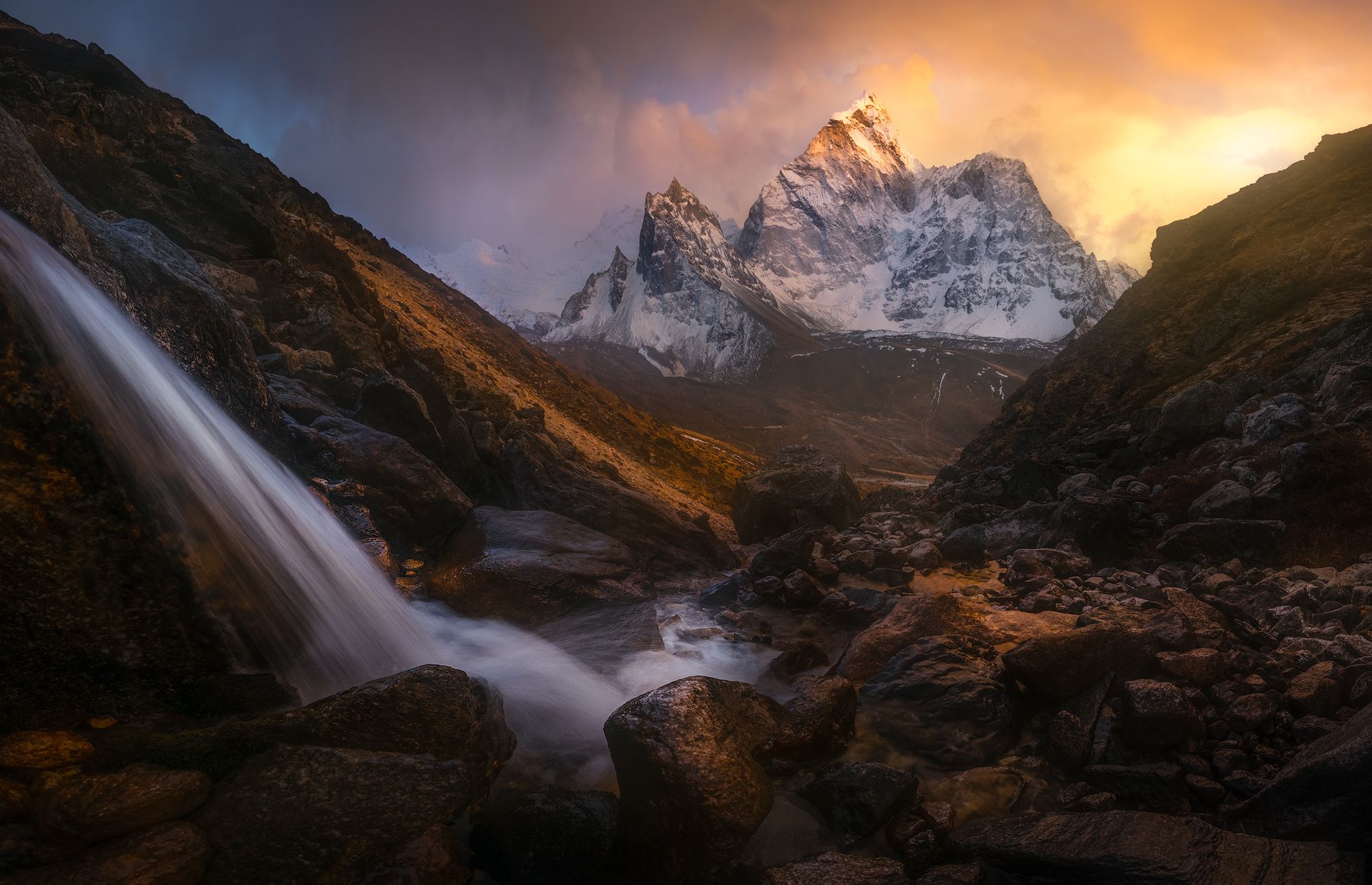
The Dingboche area is fantastic for shots of Ama Dablam. The acclimatization hike to the peak above the village will give you an incredible view of Ama Dablam, Cholatse, and the surrounding valleys. Also, stroll towards Chukkung and follow the river. The river provides some nice compositions with Ama Dablam as your focal point.
- Pangboche River Crossing

The river crossing (on-trail) by Pangboche is a great place to photograph Ama Dablam. The river is a great leading line into the mountain. Either shoot from the bridge or hike along the shore to find a view you like.
- Pheriche Valley

The Pheriche Valley offers one of my favorite views of Cholatse and a great view of Ama Dablam. Hike from Dingboche towards Lobuche and views will be everywhere. Around Dzongla, there are great compositions looking back at Ama Dablam.
- Kala Patthar

The hike up is a killer and it represents the highest point of the trek at 18,500 feet. But, the view from Kala Patthar is amazing. It is a panoramic view with Everest and Lhotse at the forefront. You can spot Everest Base Camp from the peak as well, it will be a tiny dot.
- Hill above Namche Bazaar

The hill above Namche Bazaar (Khumjung) provides great views of the surrounding mountains. It will be your first look at Everest, as well as Ama Dablam. The view of Kangtega is great and dominates the field of view from the hill.
- Gokyo Region
I did not make it to Gokyo, but I can say that Gokyo Ri and Renjo La offer incredible photographic opportunities for those who can endure the respective hikes. Many say that the view of Cholatse from Gokyo Ri is one of the most beautiful views in the world.
Guided or Unguided?
The trek can be done unguided or guided. Guided will cost you much more, but everything will be taken care of for you. Unguided will save money and is relatively easy to do with a little bit of research and planning. I did the trip unguided and the logistics were easy after some research. I recommend purchasing a guidebook if you intend to do the trip unguided. The trails are easy to follow, popular, and there are many establishments and villages along the way. Trekking in the area is nothing like wilderness backpacking.
If you do go guided, I recommend finding a Nepali guiding service online or finding a guide in the popular tourist area of Kathmandu called Thamel. I recommend staying in Thamel before your trek. It is where the majority of trekkers stay. There are many gear shops and guiding operations in the area. Most will set up a guided trip for you and the price will be much cheaper versus booking in advance through an online outfitter, but I would recommend doing research ahead of time to learn who the most reputable guiding companies are out of Thamel.

A guided hike will also give you one great advantage – porters. With the help of porters, you do not need to carry any of your gear if you do not want to. This is great for us photographers who have heavy cameras and tripods, and you will really feel that weight at high altitude. You can also only hire a porter and skip on a guide.
Where to Stay?

As I said, the trek is not like a wilderness backpacking trip. You do not have to sleep in a tent or carry any food.
Villages line the popular routes to Everest Base Camp and each village has many ‘teahouses’. The teahouses are essentially family-run lodges that offer basic accommodation and food. They cost anywhere from five to fifteen dollars a night and require you to eat your meals at their restaurant.

The setup is great because you can save a lot of weight by not having to carry a tent, sleeping pad, or food. I recommend carrying a 20-degree sleeping bag for the trip so you are warm sleeping each night.
The rooms resemble basic dorm rooms, usually two beds and a shared bathroom somewhere nearby. As you get higher and higher, the bathrooms deteriorate quickly. Around Namche Bazaar, there were western toilets, but at Gorak Shep, you will be faced with a hole in the ground

The common restaurant area is heated by a wood stove and is a great place to spend your nights, as many trekkers congregate to talk about their travels and experience on the trail.
Food & Water

Food is pretty good at the restaurants along the trek. Each teahouse has a good range of options on their menu, everything from rice to pasta dishes. The go-to meal is the Nepalese dish of dhal bhat. It is a lentil dish with vegetables and sauce. I ate dhal bhat at least once a day. Food is cheap, anywhere from two to fifteen dollars per meal, depending on what you order (dhal bhat is around four to eight dollars). You can also buy snacks along the way. I bought quite a few Snickers bars during my trek.

I recommend not eating meat or salads along the hike. It is forbidden to butcher animals in the Everest Region, which means all meat is packed in. You never know how old meat is or how long meat has been sitting out unrefrigerated. Do not risk getting food poisoning. Many fresh vegetables are washed with contaminated water as well, so cooking vegetables is crucial to kill any bacteria.
Water is provided at all teahouses. You can do this with a water filter (I used a LifeStraw water bottle, which worked awesomely). You can also request boiled water from the kitchen at teahouses. Bottled water can also be purchased at every teahouse.
Do not risk your trip by chancing food poisoning or a water-borne sickness. I was sick of dhal bhat for sure, but I did not get sick from food.
Flights

I recommend booking with Yeti Airlines for your flight to Lukla (Tenzing Hillary Airport). The airport is intimidating, but many flying restrictions have increased safety. Many of the accidents that have taken place at the airport are due to bad weather. Flight operators have learned to not take chances and if conditions are not good for flying, flights will be rescheduled.
This means that your flight to or from Lukla could be delayed by a few hours or a few days. A good reason to purchase travel insurance. My flight to Lukla was delayed by 3 hours, while my flight back from Lukla was delayed by a day.
Summit Air, another operator, had an issue with one of their planes when I was scheduled to fly out. I was on the next flight, and their plane skidded off the runway due to a malfunction and three people were killed. It was a freak accident and an extreme tragedy for everyone involved.
Altitude Sickness
Altitude sickness is a real concern. Acclimatization days are essential and drastically reduce your chance of getting sick. There are no predictors for altitude sickness, it just happens, some people are affected, and others are not.
I got altitude sickness in Dingboche. It totally took me out for 1.5 days. I felt nauseous, extremely tired, and had no energy to do anything (I did not have a piercing headache though). I heavily exerted myself the night before hiking to a photo location and I did not eat or drink enough water afterward. I think that lead to my altitude issues.
Look into prescription Diamox. It helps prevent altitude sickness. I took it for the entire trip, and still got a bit sick, but it was brief and after it passed, I pushed on to 18,500 feet and felt great. Diamox made me feel lethargic, but it did help combat the altitude.

We offer world-class travel photography
experiences around the world.
Each tour is bundled with lodging, meals, and transportation between workshops included, allowing you to focus on photography instead of the stress of traveling.
experiences around the world.
Each tour is bundled with lodging, meals, and transportation between workshops included, allowing you to focus on photography instead of the stress of traveling.
Get Our Trip Catalog
Receive a trip catalog that highlights all of our upcoming photo tours and workshops.Schedule a Trip Consultation
Meet with a photo experience coordinator, and experience a personal touch to your booking experience.Trip Calendar
View our trip calendar and filter upcoming departures by interest or seasonality.Webinars
Our regularly hosted webinars provide photography instruction from our own guides on a wide range of topics.Education Portal
Explore our library of articles that cover everything from common questions, to in-depth guides on how to achieve that perfect shot.BACKCOUNTRY JOURNEYS
"Backcountry Journeys offers guests the unique opportunity to explore our natural world from behind their own lens. We run a selection of hand-crafted Photo Tours, Workshops & Safaris connecting passionate people to exceptional experiences. Locations worldwide.
- Russ Nordstrand, Backcountry Journeys Founder & Director
- Russ Nordstrand, Backcountry Journeys Founder & Director
TRIP CATALOG
Download our Trip Catalog for detailed information on our many destinations for photography tours, workshops, and safaris.
All Images & Content are property of Backcountry Photography Tours, Workshops & Safaris LLCs - Copyright 2025
BACKCOUNTRY JOURNEYS
"Backcountry Journeys offers guests the unique opportunity to explore our natural world from behind their own lens. We run a selection of hand-crafted Photo Tours, Workshops & Safaris connecting passionate people to exceptional experiences. Locations worldwide.
All Images & Content are property of Backcountry Journeys Photography Tours, Workshops & Safaris LLC - Copyright 2025
TRIP CATALOG
Download our Trip Catalog for detailed information on our many destinations for photography tours, workshops, and safaris.